
Short hikes and walks
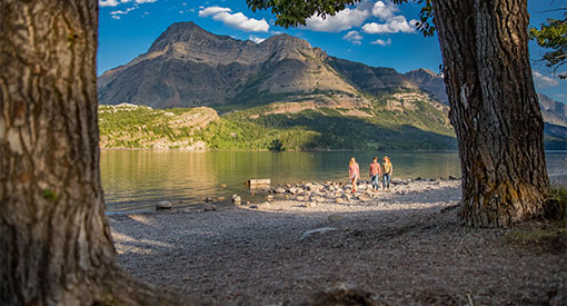
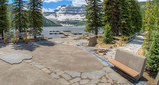
Waterton Lakes National Park
Around town
Townsite
Length: 3.2 km / 2 mi loop.
Time: 1 hour.
Level of difficulty: Easy.
Elevation gain: Minimal.
Trailhead: Join the trail at various points throughout the townsite. The Marina and Cameron Falls offer plenty of parking.
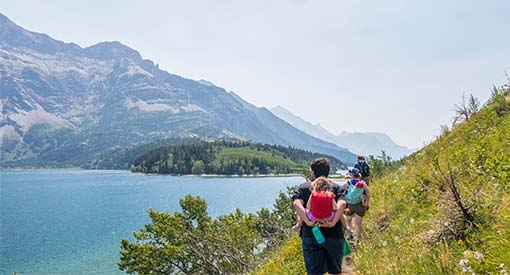
Paved path around the community of Waterton. Follows the shore of Upper Waterton Lake and Emerald Bay. Stop by Cameron Falls and visit the International Peace Park Pavilion.
Trail includes interpretive panels.
Prince of Wales
Length: 2 km / 1.2 mi loop.
Time: 45 minutes.
Level of difficulty: Easy.
Elevation gain: Minimal.
Trailhead: This trail has three starting points: Linnet Lake Day Use Area, Emerald Bay Day Use Area and the Prince of Wales Hotel itself.
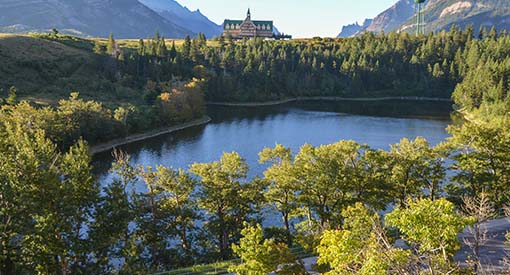
Loop around the hill below the iconic Prince of Wales Hotel National Historic Site, with views of Upper and Middle Waterton lakes.
Linnet Lake
Length: 1 km / 0.6 mi loop.
Time: 20 minutes.
Level of difficulty: Easy.
Elevation gain: Minimal.
Trailhead: Parking lot on the east side of the Entrance Road, just past the Parks Canada operations area.
A short stroll on a paved path around a small lake, named for a small bird called a linnet.
Trail includes interpretive panels.
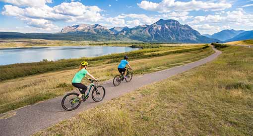
Kootenai Brown Trail
Length: 13.8 km / 8.6 mi (return).
Time: 0.5 to 2 hours.
Level of difficulty: Easy.
Elevation gain: Minimal.
Trailhead: Start at the Park Gate or Linnet Lake Day Use Area (trail follows the Entrance Road).
Paved cycling/walking path that follows the length of the entrance road. Great views of lakes, prairie and mountains.
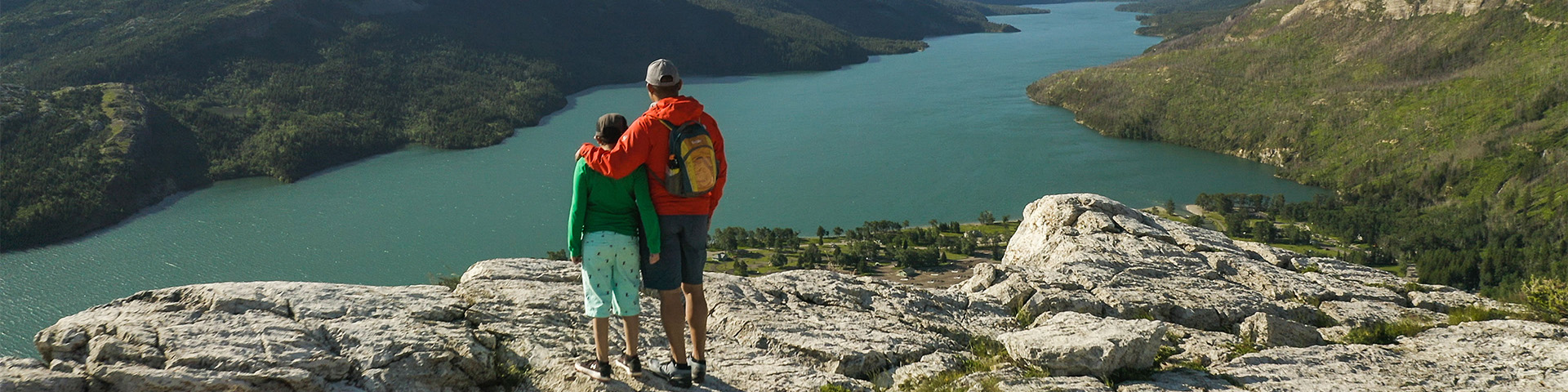
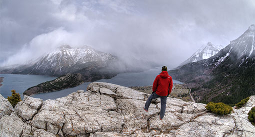
Bear's Hump
Length: 2.8 km / 1.8 mi (return).
Time: 1 hour.
Level of difficulty: Moderate.
Elevation gain: 225 m / 738 ft.
Trailhead: Across the Entrance Road from the Prince of Wales Hotel access road. If walking from the townsite, the trailhead is at the crest of the hill on your left.
This short, but very steep trail takes you to a bluff on the side of Mount Crandell, known to the Blackfoot as Bear Mountain. Views from the top are spectacular, including the Townsite, the Waterton Valley and lakes, south into Glacier National Park, U.S. and northeast to prairie ranch land.
Bertha - Lower Bertha Falls
Length: 5.2 km / 3.2 mi (return).
Time: 1.5 hours.
Level of difficulty: Moderate.
Elevation gain: 175 m / 574 ft.
Trailhead: Parking lot on Evergreen South, 350 metres south of Cameron Falls.
The Bertha trailhead is in an avalanche path. Check the Bertha-Townsite avalanche advisory (updated daily) before accessing the area.
There are several options on this hike. It starts with a moderate climb from the townsite to a viewpoint overlooking Upper Waterton Lake. From there you can choose to head south along the lake (Lakeshore Trail) to Bertha Bay, Boundary Bay and into Glacier National Park (United States). Another option is to follow the creek to a cascading “bridal veil” waterfall, Lower Bertha Falls. From there you can continue up steep switchbacks, past brief views of Upper Bertha Falls and on to Bertha Lake.
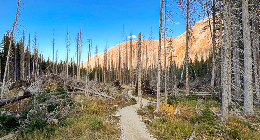
Crandell Lake (from Townsite)
Length: 12.4 km / 7.7 mi (return).
Time: 4 hours.
Level of difficulty: Moderate.
Elevation gain: 270 metres / 886 feet.
Trailhead: Where the Akamina Parkway begins.
Starts in the Waterton townsite and runs parallel to the Akamina Parkway before turning through a renewing forest landscape towards Crandell Lake. It is a steady climb from the townsite until you near the lake. This is a popular mountain biking trail. Cyclists should be aware that this trail is shared with hikers and walkers.
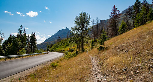
Akamina Parkway
Akamina Parkway is open to vehicles to Little Prairie day use area.
Cameron Lakeshore
Length: 3 km / 1.9 mi (return).
Time: 1 hour.
Level of difficulty: Easy.
Elevation gain: Minimal.
Trailhead: Facing the lake from the parking lot, trailhead is on the right.
A walk along a scenic subalpine lake with views south to a lush headwall in Glacier National Park, U.S.
Trail includes interpretive panels.
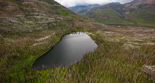
Akamina Lake
Length: 1 km / 0.6 mi (return).
Time: 30 minutes.
Level of difficulty: Easy.
Elevation gain: Minimal.
Trailhead: From Cameron Lake parking lot, trailhead is beside the washrooms on the left when facing the lake.
A short stroll to a sheltered subalpine lake.
Crandell Lake (from Akamina Parkway)
Length: 3.6 km / 2.2 mi (return).
Time: 1 hour.
Level of difficulty: Easy.
Elevation gain: 75 m / 246 ft.
Trailhead: Approximately 7 km along the Akamina Parkway, on your right when driving from town.
Family hike through a renewing forest landscape. A steady uphill slope leads to a rewarding view of a beautiful lake.
Red Rock Parkway
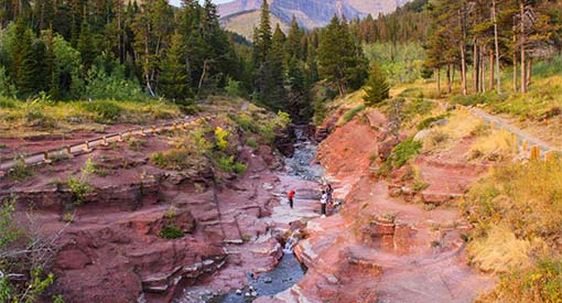
Red Rock Canyon
Length: 0.7 km / 0.4 mi loop.
Time: 20 minutes.
Level of difficulty: Easy.
Elevation gain: Minimal.
Trailhead: Red Rock Canyon upper parking lot. Trail starts at the interpretive panels.
A paved trail around and across a colourful canyon with red, white and green rock (upper bridge closed).
Trail includes interpretive panels.
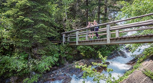
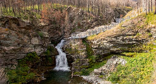
Blakiston Falls
Length: 2 km / 1.2 mi (return).
Time: 45 minutes.
Level of difficulty: Easy.
Elevation gain: Minimal.
Trailhead: Red Rock Canyon lower parking lot. Walk past the kitchen shelter, cross the bridge over Red Rock Creek, then left across the bridge over Bauerman Creek and turn right.
A short walk from Red Rock Canyon leads to a waterfall with view points.

Crandell Lake (from Red Rock Parkway)
Length: 4 km / 2.4 mi (return).
Time: 1.25 hours.
Level of difficulty: Easy.
Elevation gain: 125 m / 410 ft.
Trailhead: At Crandell Mountain Campground access, continue across bridge for trailhead parking. Trail begins at locked vehicle gate on gravel road.
A great family hike with a steady uphill slope along a former cart track to a beautiful lake.
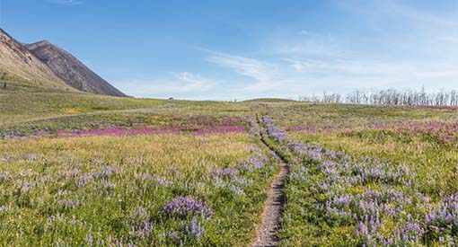
Bellevue
Length: 7.4 km / 4.6 mi (return).
Time: 2.5 hours.
Level of difficulty: Moderate.
Elevation gain: Minimal.
Trailhead: South: Look for the bear exhibit approximately 3.5 km along the Red Rock Parkway. North: Follow the dirt road past the Bison Paddock until you arrive at the parking area. Go through the gate to start.
A prairie walk below Bellevue Hill with spectacular spring and summer wildflowers. A great way to experience the distinctive "where the mountains meet the prairie” Waterton scenery.
Related links
- Date modified :