
A park less travelled
Waterton Lakes National Park
Popular areas like Red Rock Canyon and Cameron Lake can feel congested at peak periods in late spring, summer and early fall. If you prefer to visit with some solitude, visit one of these spots that may offer some tranquility. Many people find that quieter places in the park make the best memories.
Maskinonge
East of the park gate turn on Highway 6, cross the bridge and take the first right (day use area) or second right (overlook).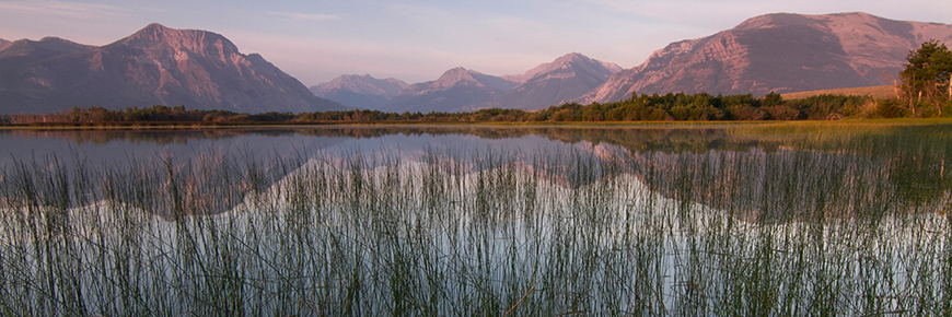
Located near the park gate, the Maskinonge is primarily wetland, featuring much of what makes Waterton special - clear, cold, clean waters, colourful and abundant plant life and a rich gathering of wildlife. Spend the day at one of the many picnic sites in the area. Siksikaisitapi (Blackfoot) people trace the origins of the sacred Beaver Bundle to this place. The Beaver Bundle is central to Niitsitapi cultural and spiritual practices. Parks Canada’s archaeologists have found Indigenous campsites throughout the surrounding area. This sacred landscape is also home to a Blackfoot Confederacy Marker.
Did you know?
The Siksikaisitapi word for the Maskinonge area is Aohkiaahkoinimaan (oohki-ah-koin-ii-maan), meaning Water Nation Pipe.
Bison Paddock Overlook
On highway 6, turn west onto the Bison Paddock access road. Turn left into the Overlook parking area.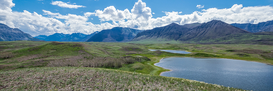
Before driving the Bison Paddock Loop road, stretch your legs at the Bison Paddock Overlook for a one-of-a-kind view! Watch the plains bison herd roam in the summer paddock, and gain a new perspective of the Horseshoe Basin area. When the sun dips behind the mountains, visit the overlook to view the park’s incredible night sky. In 2017, Waterton Lakes National Park and Glacier National Park of the United States were recognized by the International Dark Sky Association (IDA) as an International Dark Sky Park.
Did you know?
Waterton Lakes National Park has maintained a herd of plains bison, in its bison paddock since 1952.
Horseshoe Basin
On highway 6, turn west onto the Bison Paddock access road. Continue past the paddock gate, to the trailhead parking lot.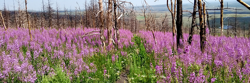
This is a great place to check out wildflowers in spring and summer. Watch the eagle migrations in the fall along the eastern mountain slopes. Walk in the footsteps of Indigenous peoples who have visited this special place for thousands of years. Make it a full day by completing the Horseshoe Basin Trail (21.3km return, 350m elevation gain).
Did you know?
From an aerial view, this area resembles the shape of a giant horseshoe, earning its name.
Bellevue Trail
Take Red Rock Parkway from the Entrance Road to the Bellevue roadside pullout.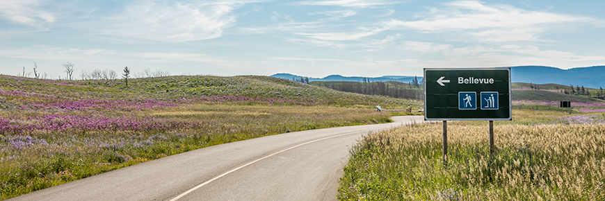
This 7 km trail links the Horseshoe Basin access road and Red Rock Parkway. Most commonly accessed off Red Rock Parkway, this hike follows the prairies where they border the mountains. With minimal elevation gain, it is excellent for wildflower viewing, especially in late spring. Parks Canada’s Archaeologists have found evidence of Indigenous presence in this landscape for thousands of years.
The eastern view overlooks the old bison hunting drivelanes, and campsites scattered along the base of the mountain. Continued efforts are underway to restore these native grasslands through use of prescribed fire and restoration projects. You can help by practicing Play, Clean, Go, always staying on trail when hiking, and reporting any chance archaeological finds to the park without disturbing them.
Did you know?
The name "Bellevue" is French for "beautiful view".
Chief Mountain Lookout (Waterton Valley Viewpoint)
Take Chief Mountain Highway south towards the U.S. border. Look for the parking area on your right, after about 6 km.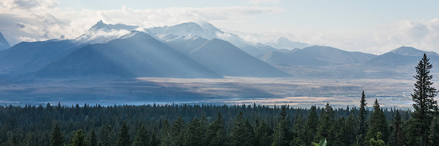
Don’t forget to bring your camera! This roadside pullout, with washrooms, delivers a picture-perfect view of Lower, Middle and Upper Waterton lakes. It offers sweeping vistas of the Waterton and Blakiston valleys, where the mountains meet the prairies. In the winter months, the road is closed to vehicle traffic making it a good winter walking and snowshoeing destination.
Did you know?
This overlook is sometimes called ‘two flags’ by locals, because of the Canadian and American flags that fly there. They represent the Waterton-Glacier International Peace Park World Heritage Site
Wishbone Trail
Take Chief Mountain Highway South towards the U.S. border. Parking area (on left) and trailhead (on right) are located approximately 250m from Highway 5.
Whether you’re into hiking or biking, this is the place for you. This trail winds its way near both Lower and Middle Waterton lakes, at the base of Vimy Peak. Offering year-round experiences, explore this area to watch wildlife and spend the day on the south shore of Middle Waterton Lake. Before heading out, review the park's trail conditions and important bulletins for the most up to date information.
Did you know?
This trail’s name refers to the shape of the gullies and seasonal streams on the slopes of Vimy Peak, as they resemble the shape of a bird’s furcula (wishbone).
- Date modified :