
The South Nahanni region offers spectacular hiking opportunities mostly accessible by boat from the river corridor. While there are no formal trails established in the park, heavy use has resulted in some of the more popular routes becoming quite well defined. Detailed route descriptions have been prepared for Hole-in-the-Wall Lake and the Tł’ogotsho Plateau, and are available upon request.
The following contains some general information on some of the more popular hikes in and around the park.
- Glacier Lake
- Secret Lakes
- Sunblood Mountain
- Marengo Falls
- Scow Creek - Headless Range
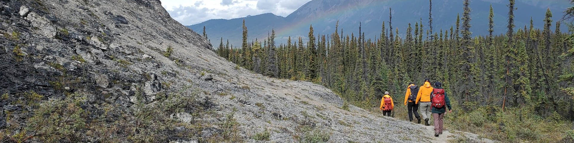
- Prairie Creek
- Sheaf Creek - Tł’ogotsho Plateau
- Dry Canyon Creek
- Ram Creek
- Lafferty Creek
Glacier Lake
Glacier Lake is a gateway to the Ragged Range and the "Cirque-of-the-Unclimbables." Access is gained from the South Nahanni River, north of the park boundary.

©Parks Canada / J.W.Borcoman
Depart northwest from the mouth of Britnell Creek, following the trail along the bank of the South Nahanni. The trail is indistinct, but old blazes will be apparent along the way. After 1 km, a snye (a side channel) coming off the South Nahanni will be encountered. Look for a heavily blazed pine tree about halfway along the snye. The trail makes a 90-degree left turn and heads southwest at this point. Follow the trail over rolling hills until it nears Britnell Creek, then head to the west and follow the north bank of the creek to Glacier Lake. Calling this route a "trail" is an understatement. There may be plenty of occasions when the trail will be temporarily lost or confused with game trails and also has been referred to as a "thrash."
Secret Lakes
The Secret Lakes are a series of small, deep lakes nestled in a steep-sided mountain valley. There are two routes of access described below:
i) Depart from the high, northwestern bank of the South Nahanni River immediately below the mouth of the Rabbitkettle River. Travel east through muskeg, creek beds and game trails, then over a low pass into the Secret Lakes Valley (6 km one-way).
ii) Hike up the creek bed joining the South Nahanni River at Km 15. The creek bed will take you into the Secret Lakes valley on a gradual incline, making a longer but less strenuous trip than the above route. Most of the creek bed consists of gravel and small boulders (10 km one-way).
Sunblood Mountain (8 km one-way)
The trailhead is located directly across the river from the Virginia Falls campground. You should travel upstream a sufficient distance before ferrying to the other side of the river to ensure a safe crossing. Hike northeast through a mature spruce forest until you reach the open scree ridge and continue to the peak of Sunblood Mountain utilizing sheep trails and open slopes, but be careful on the treacherous scree. Plenty of water will have to be packed along for the trip.
Marengo Falls (4 km one-way)
A compass or GPS and a map are required for this hike. Depart from Virginia Falls campground following a compass bearing to Marengo Falls. Depart in a southwesterly direction through a terrain of hummocks, mossy spruce and muskeg interspersed with higher ridges of pine. A drier, alternate route is to depart l.5 km upstream of the campground. If your bearing is reasonably accurate you will arrive at Marengo Falls, where Marengo Creek cascades 30 metres over a series of limestone ledges.
More often than not you will come out to the creek either up or downstream. Orient yourself by observing the creek. Above the falls it meanders through a grassy, low plain, while below it flows somewhat faster through a wide gravel bed.
Scow Creek - Headless Range (8 km one-way)
Depart from Scow Creek where it joins the South Nahanni River at km 214. Hike south up the gravel and boulders of the largely dry creek bed. A fork in the creek bed will be reached after 2 km, continue up the right hand or west fork. After a further 1.5 km a smaller creek bed on the left can be used, along with open ridges, to climb the range. A more gradual route is to continue along the original channel that climbs a low saddle leading onto the range. Once on top and above the tree line, sheep trails lead northeast along the ridges through small plateaus of rock, and stunted alpine vegetation. Several small ledges and waterfalls in the creek beds will have to be climbed detoured around. Water availability will vary according to wet or dry periods during the season.
Prairie Creek (4 km one-way)
The Prairie Creek alluvial fan is a major feature of Deadmen Valley. Begin hiking upstream (north) staying to the left (west) of Prairie Creek's many channels. After 1.5 km, the creek channel undercuts a low, silty bank. You will either have to climb over this bank (thick, tangled bush) or cross the creek (cold, fast water) then return to the west shore. Ahead will be a narrow gap where Prairie Creek exits the mountains. By climbing over a saddle to the west of the gap, you can enter a small floodplain bordered by the almost vertical canyon walls.
Bears commonly forage on the Prairie Creek alluvial fan, so be alert to avoid the possibility of a surprise encounter. Upland sandpipers nest in the prairie areas of the fan. Prior to June 10, we ask that you please restrict your activities to the gravel areas to minimize disturbance to the nesting birds.
Sheaf Creek - Tł’ogotsho Plateau (10 km one-way)
Start your hike at the mouth of Sheaf Creek in Deadmen Valley. You should stay on or near the creekbed and will have to cross the creek many times. A major forest fire in the early 1980s caused lots of trees to fall across the creekbed, which in turn makes this portion of the route a slow and difficult bushwhack. Follow the creek up to where it just about disappears at the base of the plateau. Go to your right (west), up the steep ridge leading to the plateau. This steep, mossy ridge gives way to a scree slope and extra care should be taken if hiking in wet weather. Near the top there is a small bench and fairly steep cliff. To the right of the cliff, a sheep trail leads you to the top of Tł’ogotsho Plateau. Water is not always available at higher elevations in summer, so carry along a good supply. Be prepared for extremes of weather and low cloud, which can occur suddenly, making travel and orientation very difficult.
Dry Canyon Creek (10 km one-way)
The dry gravel fan of Dry Canyon Creek is located at the far eastern end of Deadmen Valley. Hike up the impressive, steep walled canyon on the gravel beds for the first short distance. As the canyon narrows, large boulders will have to be climbed around, over and sometimes under. Several draws and ridges to the east provide access to the Nahanni Plateau although no definite route has been established. Dry Canyon is most often hiked as a day trip by following the creek bed in the canyon. Longer, overnight trips to the Nahanni Plateau are possible, but require more equipment and preparation.
Ram Creek (15 km one-way)
This route begins at the mouth of Ram Creek in Deadmen Valley, along the South Nahanni River. Ram Creek is an alternative route to the Tł’ogotsho Plateau, with less bushwhacking. Steep, eroded banks and the occasional mudslide along the way will make several creek crossings necessary. A small stream enters Ram Creek after 6 km that might be your last opportunity to fill your water bottles until you reach Boundary Lake. After hiking south for approximately 8 km, the valley begins to narrow. Hike up the north (right) slope for 150 m or more until you find a sheep trail. Following this trail through an old burn will lead you to an area with open terraces. At this point Ram Creek bends to the west. Descend to the creek bed approximately 50 m downstream of a small waterfall. Ascend the opposite (south) side of the creek and follow another sheep trail along a scree slope that will lead you up to Boundary Lake. Gain access to the top of the Tł’ogotsho Plateau by hiking north up a scree slope. The availability of clean drinking water is limited so plenty should be taken along. This route may require several days along with proper equipment and preparation.
Lafferty Creek (10 km one-way)
Lafferty Creek joins the South Nahanni River near the bottom of First Canyon at Km 260. The terrain and canyon are very similar to Dry Canyon, although Lafferty Creek usually flows above ground over most of its length. Hike up the creek bed for the first kilometre, from there the canyon becomes increasingly narrow.
Some boulder walking and steep scrambling will be necessary to get through a few tight areas. The creek will have to be crossed in several spots; usually it is low enough that you can cross on the rocks. Lafferty Creek is recommended as a day hike. Longer trips to the Nahanni Plateau and karstlands are possible with careful preparation.
- Date modified :